


Project Tohu
Project Status
Quick links
Location Map
Mihi
A mihi connects us to our whenua/provider/land, tīpuna/ancestors, and one another through time and space. A mihi is about respect, unity, and honouring the natural world that sustains people.
Te Reo Maōri
I raro kā korowai o Papatipu Rūnaka e whā o Murihiku
Kā mihi ki kā Rūnaka e whitu, kā Mana Whenua o Whakatipu Wai-Māori, Waiwhakaata, Wānaka me Hāwea
Mai i kā mauka, whakararo i te awa o Kawarau, Mata-Au, Taieri, Oreti, Mataura, Waiau, Aparima ki te moana!
Mai te arataki o kā tīpuna
E whakapūtake mō ā tātou mokopuna
I raro i kā Tapu Mauka o Kawarau, ki uta ki tai
Mai te kākano o te rakau, ka puta mai kā takata rakatira
I raro i tērā korowai,
Māori mā, Pākehā mā,
Mai te taha o te moana me te ngahere me te taiao,
Kā takata katoa
He waka eke noa tenei ki tua
Mō tātou, ā, mō ka uri ā muri ake nei.
English Translation
Under the cloak Ngāi Tahu Murihiku Rūnaka
We acknowledge the seven Rūnaka, the Mana Whenua of Whakatipu Wai-Māori, Waiwhakaata, Wānaka me Hāwea
From the mountains, down the Kawarau, Mata-Au, Taieri, Oreti, Mataura, Waiau, Aparima, to the sea
Guided by our ancestors
Spreading roots for our descendants
Under the sacred mountains of Kawarau, from the mountains to the sea
Just as we grow the seed, we grow the people
We wear the cloak of responsibility together
As Māori and as Pākehā
For our natural world
Everyone, together
This is awaka that we are all in, moving forward together
For us and our children after us
About the project
The project site covers 200 ha on the south facing slopes of Coronet Peak close to Arrowtown and rises to its highest point of 930m. Project Tohu, led by Council, will plant over 500,000 indigenous species of grasses, scrubs and trees. And in the future a community mountain bike trail network, horse and walking trails and local picnic areas will be available at the site for the community to enjoy. Head to the Project Tohu Trail Network page to read more.
The first year of this regeneration project involved site preparation and planning with a seven km fence line being installed around the perimeter of the site. Pest control operations continue to be carried out in stages to support planting survival rates. These include ariel spraying to eliminate any established Douglas Fir seedlings along with night shooting and Pindone drops to help control the rabbits and goat population. Following the completion of native planting, plant maintenance will continue from 2027-2030.
Project Tohu provides a unique opportunity to be a leading example of how large-scale ecological restoration can be successfully achieved within the Otago region and throughout Aotearoa New Zealand.
The Downstream Effect
By reintroducing native vegetation to Coronet Peak and indigenising the whenua, this project actively works to safeguard the health of our Waiwhakaata waterways reaching from the Crown basin to entering our seas in Bluff.
Project Tohu site
We celebrated a key milestone for Project Tohu in April 2025 with 80,000 native plants in the ground. The indigenous planting programme of more than half a million native grasses, shrubs and trees will continue in stages on the south-facing slopes of Coronet Peak mauka over the next three years.
The delivery of this intergenerational project is a team effort led by QLDC and delivered in partnership with Te Tapu o Tāne, Citycare Property and e3Scientific Limited. Their mahi is creating a true taoka for the community.
Please note: the green plant guards pictured are a temporary measure to protect young trees planted across the site, chosen for their durability in local climatic conditions, including strong winds and snow.


Our Project Tohu
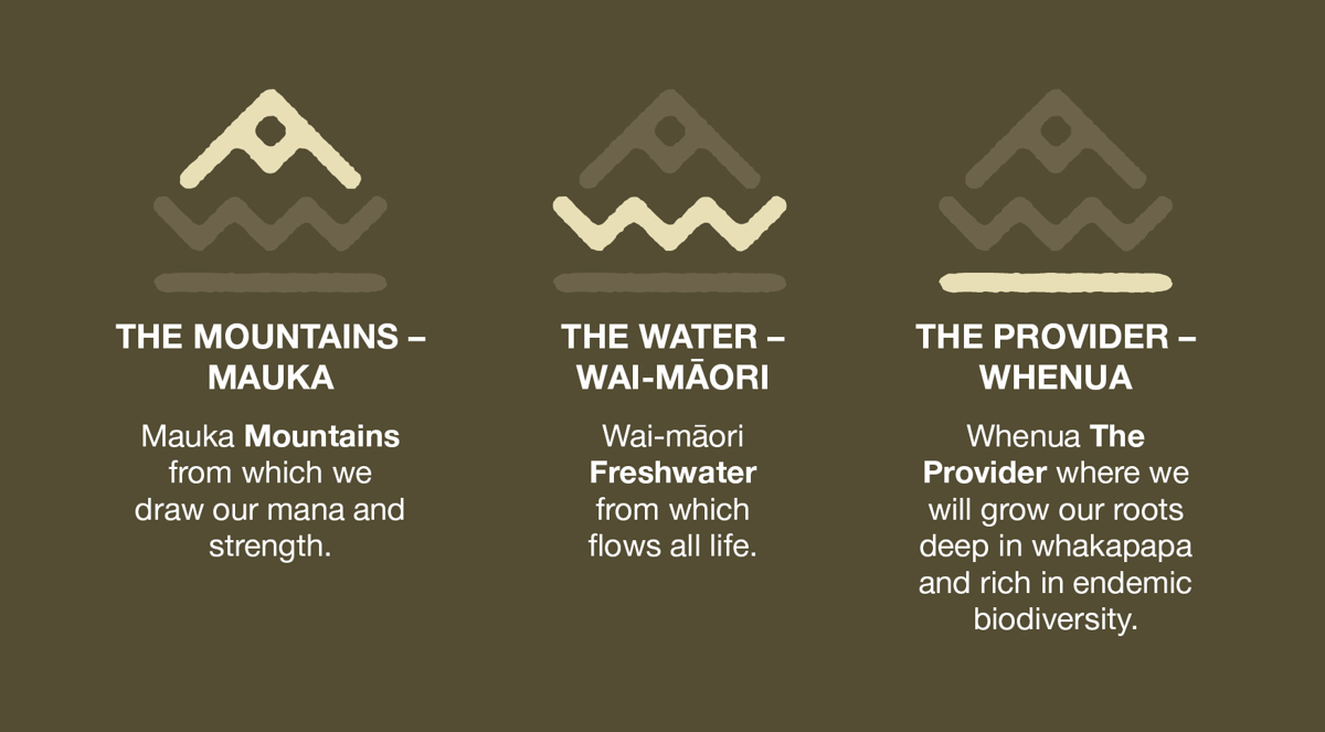
Our ‘Project Tohu’ illustration represents our three Ngāi Tahu tīpuna ancestors and our commitment to supporting Mana Whenua as kaitiaki guardians, in safeguarding their taonga and the treasures of Papatūānuku, the earth mother, for future generations.
A ‘Tohu’ is a guide, a sign, a marker that signifies a truth.

Frequently asked questions
Can't find the answers you're looking for below? Reach out to our Customer Service team on 03 441 0499 or email:
-
Designed for alpine conditions, the plastic TriGuards guards offer the durability and stability needed to withstand harsh UV, snow, strong winds, and steep terrain; conditions where standard cardboard guards simply don’t hold up. Their longer lifespan (typically 2-4 years) also means fewer replacements and less disturbance to young seedlings.
And when their job is done, they’re fully recyclable, often repurposed into fence posts, giving them a useful second life in the landscape.
-
Plant guards were initially installed on the site as a trial, with the aim of understanding whether guards meaningfully improved plant survival and protection.
The most recent audit in January 2026 showed overall plant survival above 95%. Browsing damage was recorded on around 20% of unguarded plants, but these plants are expected to recover.
Based on these results, plant guards will be targeted to areas or species where additional protection is most beneficial. For plants without guards, browsing pressure will be managed through increased pest control and the installation of rabbit‑proof netting.
-
We are planning to hold volunteer planting days, but as it’s an ex-forestry site and the terrain is pretty challenging, we’re looking to start with smaller groups before opening to larger numbers. We'll share details later this year for an event likely in Spring 2026, so keep an eye out!
In the meantime if you are keen to volunteer, you can share your details by emailing parksrequest@qldc.govt.nz
-
Mountain beech (Fuscospora cliffortioides) is the dominant species to be planted on the site and historically would have been the vegetation that would have been found on this slope. But above about 750 metres, environmental conditions become less favourable for beech trees. Colder temperatures, strong winds, heavy snowfall, and poorer soils, along with a shorter growing season limit their ability to thrive. As a result, beech forest gives way to alpine vegetation, better adapted to these conditions.
-
This has been sown with grass. Grass binds the soil and helps hold it in place. It provides ground cover that helps stabilise slopes, reduces erosion, and slows surface runoff, and can help prevent some woody weeds from establishing. We plan to plant tussock and grey shrubland species that when funding becomes available in the future.
-
The site was harvested from 2020 to 2023. The amount of slash left on the site is typical for a NZ forestry operation and met the standards in the Resource Management National Environmental Standards for Plantation Forestry 2018.
The site was harvested using both ground-based and hauler (cable-logging) operations.
Ground based harvesting leaves more slash evenly distributed across the slopes of the site.
Hauler operations tend to leave more slash at the skid site because whole trees are transported long distances before being processed. When those trees are cut and delimbed at the landing, the branches and tops become slash, resulting in a larger volume accumulating at the skid site.
-
The slash on the slopes will remain and gradually break down over time. Some accumulated slash from the skid sites will be removed; it has been donated to a local volunteer group, who are turning it into firewood to support the community.
Retaining slash on a harvested site is beneficial because returns nutrients to the soil as it decomposes, reduces soil compaction, helps suppress weed growth. The slash also benefits the new plantings by limiting browsing and providing a protective sheltered area for plants to grow and thrive.
-
Slash will naturally break down over time as it decomposes. During this process, some movement within the site may occur, as the slash settles while breaking down and as tree roots decay and settling of the material can occur as the slash compacts and as old tree roots decay. New trail locations have been carefully planned to minimise any effects from the natural breakdown of material. Grassing and replanting the site with over 500,000 native plants will also help stabilise the area.
-
A seven-kilometre fence line has been installed around the perimeter of the site to keep out goats and deer. Rabbit proof netting is currently installed to 750 meters elevation, and there are plans for further rabbit proof netting to be installed around the site in March 2026.
There is a large population of goats in this area. Although goat control is carried out on this site and neighbouring sites in collaboration with neighbours, goats can severely damage and even destroy native plantings. That’s why we ask everyone to please be mindful and shut gates behind you.
-
The plan is for the fence to remain in place while there is still pressure from external pests. The site is very large, making it difficult to respond quickly to pest activity. By having a fence in place, we are creating a barrier that can help reduce or even eliminate pests that could destroy valuable plantings.
-
The purpose of a sediment pit within the site to keep waterways below the site clean. Their role at Project Tohu is to capture and control sediment runoff and lose soil before it leaves the site and enters the wider Waiwhakaata/Lake Hayes catchment.
There are a number of sediment pits across the site most are located along the edges of roads, where they are easily accessible for maintenance and clearing.
-
The contract to restore the biodiversity of Coronet Forest with natives was awarded to Te Tapu o Tāne (TTOT) and e3Scientific Limited in April 2024. Under this contract TTOT are responsible for planting over 500,000 indigenous species of grasses, scrubs and trees. The first planting occurred in Autumn 2025 and planting will continue over three years. Plant maintenance will continue from 2027-2030.
e3Scientific Limited is a key delivery partner responsible for providing expert environmental science support, including technical guidance, ecological planning, monitoring, and restoration implementation to help reinstate native vegetation and ensure successful largescale ecological restoration at the site.
-
The revegetation projects vision is to:
- Promote the natural regeneration of native vegetation and provide biodiversity and a habitat for native wildlife.
- Meet the expectations of the community and provide recreation for future generations to enjoy through the establishment of walkways, biking tracks, horse trekking trails and picnic areas.
The revegetation will take place over several years and the trail network plan is to be staged. Many of the trails will have shared use, with the design providing for loops of varying lengths and difficulties, while providing uphill and downhill trails opportunities.
-
The area does not yet have an ‘official’ name. By default, the site had been called Coronet Forest in the past, but now the trees are gone there is an opportunity for the site to reimagined.
QLDC will consult with iwi on naming and trail signage. There are opportunities to sharing mana whenua histories, narratives and cultural identity through pūrakau/stories and mana whenua interpretation panels at the site.
-
From spatial mapping to ecological modelling, a range of systems are now embedded across the site, helping guide planting and monitor progress with precision. At the heart of this is a suite of smart systems guiding and tracking progress across the site, including:
- GIS (Geographic Information Systems)- data analysis and mapping & LiDAR (Light Detection and Ranging) – data collection elevation mapping is used to overlay terrain, hydrology, and biodiversity data
- Digital field logging to monitor plant survival and site conditions in real time
- Smart predator traps capable of self-resetting and rebaiting (49 times more efficient than single set traps).
While smart systems offer precision and efficiency, they’re grounded by more traditional techniques like manual plant health checks, seasonal soil and water monitoring, and ecological surveys. This duality of approach ensures that every decision is informed, every action is intentional, and the whenua is protected in real-time but with a long-term vision.
-
The following pests were controlled with the site as of January 2026:
Hare - 44
Rabbit - 86
Possum - 46
Goat- 31
Mice - 2Outside of the site we partnered with Manu Whenua and eliminated approximately 300 goats around the boundary of the Project Tohu site in November 2026.
Partners
He waka eke noa, we are all in this waka together
The contract to restore the biodiversity of Coronet Forest with natives was awarded to Te Tapu o Tāne and e3Scientific Limited in April 2024.
The Coronet Forest kaupapa is all about building on the partnership between QLDC, Mana Whenua, Te Tapu o Tāne and Citycare Property, as well as the kaimahi at e3Scientific.
We are excited to be working together with our partners and the community to reinstate beech forest to the slopes of the Coronet Range. Ultimately this project is about helping to restore and protect our local natural environment for generations to come.
-
We navigate tough and complex business challenges in the space of te taiao, landscape and construction, wholesale nurseries, business and strategy using tried and tested techniques across a range of greenspace sectors. We are proudly owned and governed by Papatipu Rūnanga o Murihiku, bringing forth the values of Mana Whenua tīpuna for the betterment of our communities.
-
A kiwi owned social infrastructure organisation, delivering world class services to central and local governments across Aotearoa. We build, maintain, operate, and renew the places and the spaces that make our communities great to live.
-
A New Zealand owned and operated environmental science consultancy.
