
- Services
- Airports
- Alcohol Licensing
- Animal Control
- Building Services
- CCTV - Public Use
- Cemeteries
- Environment and Sustainability
- Environmental Health
- Permits
- Rates & Property
- Resource Consents
- Rubbish & Recycling
- Services A - Z
- Transport and Parking
- Water Services
- Water Services CCO
Water restrictions in Queenstown Lakes District
Why are restrictions needed sometimes?
If Queenstown Lakes District residents use water faster than we can source, treat, and supply it, the amount of water in the reservoir will decrease.
Every local community will have different trigger points for when water restrictions are needed based on the characteristics of their local supply. In general, if water usage is ramping up then the appropriate alert levels will be imposed and adjusted as needed.
Water alert levels
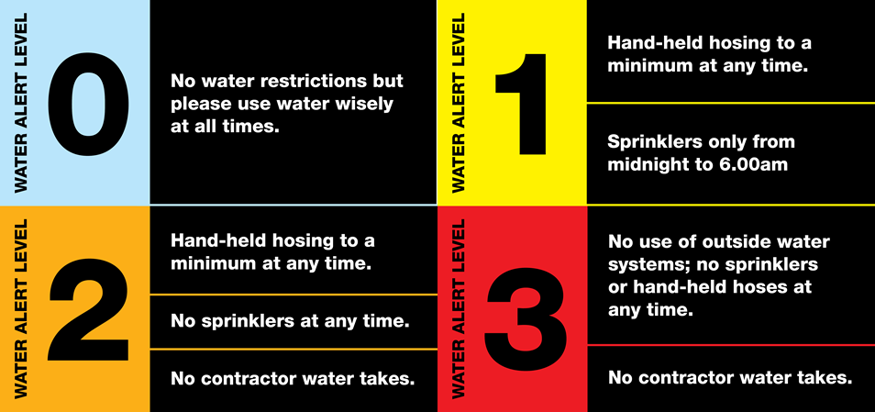
We continuously monitor water production vs usage reservoir levels across all our water schemes and alert levels will be lifted once usage drops to an acceptable level, normally coinciding with cooler and wetter weather.
Knowing your current alert level
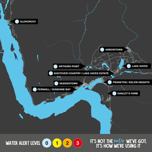
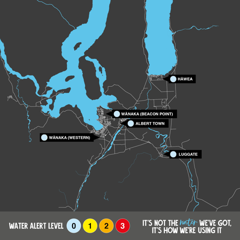
You can check your current alert level below, as well as find signage in your local community. We will also notify changes via our Community Text alerts and Facebook page.
Whakatipu Restrictions Map
-
Whakatipu Restrictions Map (PNG, 999KB)
Upper Clutha Restrictions Map
-
Upper Clutha Restrictions Map (PNG, 993KB)